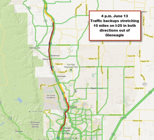
 KIRKLAND, Wash., June 13, 2013 /PRNewswire/ -- INRIX, a leading international provider of traffic information, continues to track congestion on I-25, the primary evacuation route for the Colorado Springs Black Forest fire. As of 4 p.m., travel times are nearly four times as...
